NEW DELHI — A rare storm at this time of the year has hit most parts of north and central India, as well as some areas in the south of the country. This is expected to continue at least through Monday, and perhaps slow down by Tuesday, according to the India Meteorological Department. Sunday was the rainiest day this winter.
"There was intermittent, heavy rainfall across large parts of the country on Sunday," B P Yadav, director of the Met department, told The Times of India. "Such widespread rain at this time of the year is not very common. The wet weather in north and central India will continue for at least another day."
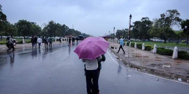
The Met department has forecast a cloudy Monday with rain accompanied by cold winds in many parts of the city.
"Delhi will see a rainy Monday. More cold wind is expected during the day while fog is expected in the evening," said a Met official.
Monday's maximum and minimum temperatures are likely to hover around 20 degrees and 15 degrees Celsius, respectively.
This storm on Sunday brought heavy rainfall to Jammu & Kashmir, New Delhi, Uttar Pradesh, Gujarat and Madhya Pradesh on Sunday, and resulted in wet weather in Maharashtra, Karnataka, and Andhra Pradesh.
What started as a routine occurrence — a western disturbance in north India — quickly spun into a cyclone in Saurashtra and Kutch, according to Yadav, resulting in the western disturbance (WD) spreading in to central and southern India. A WD is a weather system originating in the Mediterranean-Caspian Sea region and moving across the Afghanistan-Pakistan region, which brings rain or snow in the sub-Himalayan regions.
Strong wind from the central Arabian Sea, as well as from Bay of Bengal, resulted in rain. The storm will now move towards the east on Tuesday and Wednesday, according to Met officials.
The temperature plunged on Sunday, and is expected to stay low this week.
Heavy rainfall snow and rainfall would occur at isolated places in the states of Jammu and Kashmir, Himachal Pradesh and Uttarakhand in the next 24 hours.
Heavy rainfall would also occur in Punjab, Delhi, Haryana and Uttar Pradesh while some places in Vidharbha, Madhya Pradesh and Chhattisgarh would also see thunderstorm, accompanied with hailstorm, according to the Met department.
(with agency inputs)